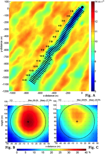
To establish a baseline with the Texas Tech University (TTU) Doppler radar, unique and novel wind farm flow mapping has been performed in either full- or semi-precipitating environments. Preliminary results to date have opened insight to full utility-scale wind-farm performance that have never been seen in any other data set, measured or modeled.

Doppler radar technologies and techniques developed at TTU have the potential to revolutionize wind energy generation by providing comprehensive information about the modulated flows within a wind farm. These technologies and techniques will enhance wind-farm design, layout practices, and operation. Documenting the structure and evolution of complex flows within and surrounding wind farms will lead to increased efficiency as:
- turbine wakes are fully characterized,
- turbine–turbine interactions are defined,
- transient wind events are proactively identified,
- the effects of local terrain are documented, and
- turbine inflows are adequately characterized.
This allows improved design and intelligent control of individual wind turbines and entire wind farms.
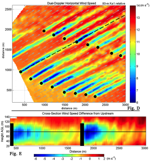
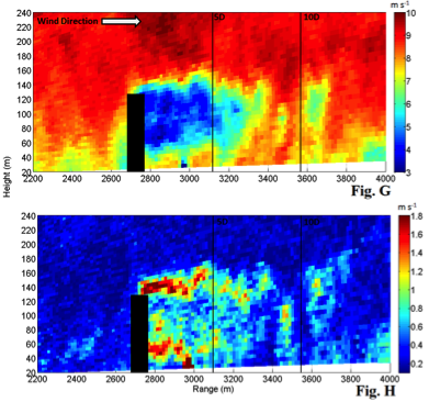
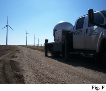
TTU is at the forefront of making full-scale wind-farm observations. Using state-of-the-art Doppler radar technologies, TTU has successfully characterized the modulated wind flow near an individual wind turbine (right) and within a broader wind-farm setting (next image set). Coordinated observations have been collected using two radar systems—allowing dual-Doppler synthesis of the three-dimensional wind flow over a large footprint with exceptional spatial and temporal resolution.
In this project, enhancements to the TTU Ka-band Doppler radar technology will lead to higher clear-air sensitivity and higher accuracy through enhanced positioning, leveling, and orientation precision. The project team will also develop focused data-collection strategies and novel analysis techniques, in part to mitigate radar artifacts that occur in nonprecipitating environments. The team will demonstrate these enhancements through additional targeted pilot data campaigns covering utility-scale wind-farm airflows with high time resolution in two and three dimensions.

The subsequent analysis will continue to provide an expanding data catalog and experience for future, more significant endeavors by these unmatched, world-class measurements. This project lays the foundation for a large-scale field campaign we anticipate in the coming years, critical to the DOE’s wind-plant optimization effort.
This project will deliver the capability to diagnose and measure full-size, utility-scale wind plants in detail, which has never been seen before. It will deliver critical insight to develop methods to reduce wind-plant underperformance. The high spatial and temporal resolutions and larger observational footprints afforded by the TTU Ka-band Doppler radars represent a paradigm shift for wind-energy-community measurement campaigns. Refining this technology will lead to more widespread usage and impact. The project offers the potential to transform wind energy worldwide, by laying the groundwork for more intelligent wind-plant design and operation.
This project’s main objectives are to:
- investigate wind-turbine-induced radar artifacts on the airflow measurement capability and implement mitigation strategies for nonprecipitating environments (with a pulse-compression Ka-band Doppler radar system);
- investigate coherency in nonprecipitating environments and develop mitigation strategies and/or future design recommendations to enhance performance in a wider range of atmospheric conditions;
- execute a targeted measurement campaign (limited to ~6 hrs of data collection from each radar) at wind farms near Lubbock (targeted wind farms will have a pre-established relationship with TTU or participate in the CREW database project to ensure turbine data can be acquired simultaneously, for data validation and further insight);
- conduct complex flow analysis of wind-farm data and conduct cross-correlation analysis of wind-farm data and radar complex flow data; and
- upgrade radar subsystems to enhance positioning, leveling, and orientation precision and accuracy.
The TTU project team recently used two high-resolution mobile scanning Ka-band Doppler radar systems to measure the flows surrounding a single utility-scale turbine at Reese Technology Center, as well as a West Texas wind farm. The team obtained several hours of complex-flow measurements within and surrounding a large wind-turbine array, covering a large section of the farm’s airflow in a cinematic way

The initial study also provided technology validation and developed analysis methodologies by comparing the radar-derived flow fields with turbine power output and nearby meteorological data. Also, preliminary analysis of zoomed data acquisition in three dimensions showed time-resolved capture of meandering wake—another example of the endless opportunities to apply this technology to wind-farm optimization efforts.
This project represents foundational work to prepare for a significant observational campaign and analysis effort anticipated in the coming years that will focus on providing a catalog of complex-flow data from varying wind farms and environmental conditions. Future measurement campaigns are expected to be joint efforts involving many other technologies and partners and to work hand-in-hand with numerical simulation efforts. These collaborations will expand and accelerate existing complex-flow knowledge and yield actionable results that impact a variety of sectors within the wind-energy community, leading to significantly reduced wind-plant under-performance.
