Wind Turbine Radar Interference Mitigation (WTRIM)
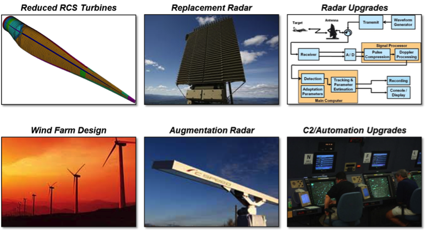
The Wind Turbine Radar Interference Mitigation project, or WTRIM, is aimed at solving deployment barriers for wind-energy systems by testing and evaluating mitigation methods which reduce or eliminate wind turbine effects on radar systems. This effort includes collaboration with industry; five government organizations, including the U.S. Department of Energy, the U.S. Department of Defense, the U.S. Department of Homeland Security, the U.S. Transportation Department’s Federal Aviation Administration, and the National Oceanic and Atmospheric Administration; and two national laboratories, including Sandia National Laboratories and MIT Lincoln Laboratory. The goal is to overcome interference caused by wind turbines on civilian and military radar systems by developing site planning tools, delivering technical assistance, and fostering interagency collaboration.
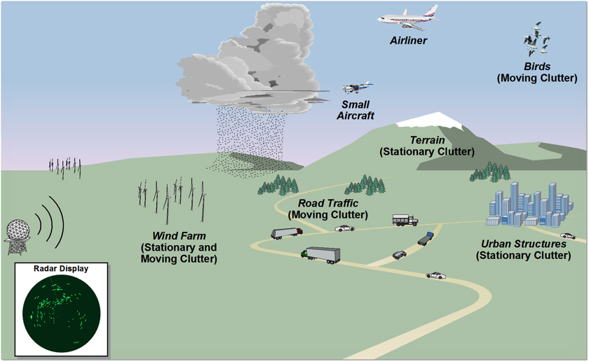
This activity is focused on the continuing effort to:
- fully understand the effects of wind turbines on the environment in which they are placed
- identify the barriers in the way of renewable energy development
- suggest mitigation solutions to these barriers, where available.
TSPEAR
Part of this effort will focus on validating and expanding the capabilities of the Tool for Siting, Planning, and Encroachment Analysis of Renewables. The TSPEAR effort will provide a core siting framework interface in which multiple advanced best practice siting tools such as wind turbine/radar interference models, environmental impact models, and transmission access models can be accessed.
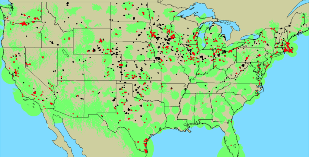
The initial effort involved developing the TSPEAR framework, as well as a wind turbine/radar interference model. The effort will include validation of this radar interference model with data collected during the Interagency Field Test and Evaluation (IFT&E) program. This effort is vital to the establishment of a robust, accurate radar model. The effort will also expand the capabilities of the radar model to include multiple electromagnetic wavelengths branching to other radar technologies and a more robust definition of the wind turbine radar cross section for each technology.
The effort to develop accurate wind turbine/radar interference models will ultimately improve the understanding of the impact, and allow viable paths to the deployment wind energy across the country. Sandia will support the research and development of these technologies while also providing an overarching framework to streamline the overall process of siting evaluation.
The current TSPEAR project objectives are to:
- validate the wind–turbine–radar interference models developed in the initial phase of TSPEAR framework development, leveraging work performed by the IFT&E team
- improve the capability of the radar model to address other radar technologies (i.e., ARSR-4 and ASR–11 radar)
- use the modeling capability developed to better assess the individual rotor blade RCS returns on the performance of certain radar technologies and help inform the amount of RCS reduction required within the blades themselves to mitigate the electromagnetic interference issue leading to increased false alarm rates and decreased Probability of Detection for deployed radars.
Interagency Field Test and Evaluation
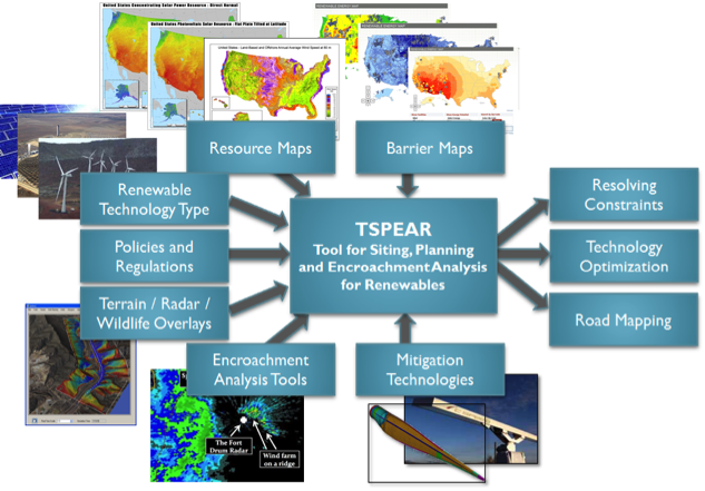
Sandia continues its efforts to understand and mitigate the effect of wind turbines on civilian and military radar systems by supporting the Interagency Field Test and Evaluation (IFT&E). The IFT&E program was established in response to directives from Congress and the White House to investigate and address the concerns of the growing interference of wind turbines on our nation’s air surveillance radars. The program was funded and supported by the U.S. Department of Energy, U.S. Department of Defense, U.S. Department of Homeland Security, and the U.S. Department of Transportation’s Federal Aviation Administration. Two national laboratories were responsible for designing, executing, and analyzing the tests: Massachusetts Institute of Technology Lincoln Laboratory and Sandia National Laboratories. The program had three goals:
- characterize the impact of wind turbines on existing air surveillance radars
- assess near-term mitigation capabilities proposed by the industry
- collect data on and increase the technical understanding of interference issues to advance long-term mitigation strategies
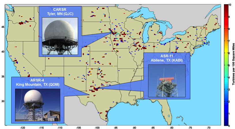
The program was a two-year effort with three flight campaigns to evaluate a long-rage common air surveillance radar, a short-range airport surveillance radar (for this test, an ASR-11), and a long-range air route surveillance radar (for this test, an ARSR-4), respectively. Eleven different mitigation concepts were assessed in this program.
Current work supports research and development activities focused on evaluating the potential for an offshore test.
Contact
Ben Karlson
bkarlso@sandia.gov
